 The third group of panorama compositions were created on the Sunday visit with our Ang Mo bud to Provincetown aka Gay town. The weather was foreboding the minute we left Boston harbor, and stayed cloudy for most of the rest of the day.
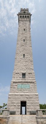
The compositions were from two places: the first two, including the one on the right, were done from the base of the Pilgrim Monument Tower.
I haven’t done nearly as many vertical panorama compositions like the one on the right here, as compared to the typical horizontal panoramic sweeps. But it’s much easier getting acceptable results. Distortions with vertical compositions especially if you’re dealing with straight structural lines typical of tall buildings pointing towards the composition’s top edges.
That’s as compared to the horizontal sweeps where as you approach the corner images, perspective gets significantly skewed; you can see it tellingly from about the leftmost and rightmost quarters of each image.
I’ve been experimenting with compositions comprising two and up to as many as a dozen images, and alternating between shooting in landscape and portrait modes. And so far, the (somewhat) best results seem to come from compositions involving three or less images, landscape mode, and shot at about 24mm onwards.

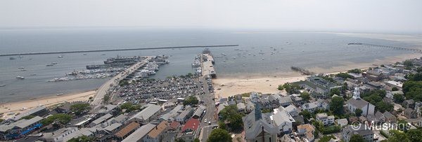
The next three compositions below were at the top of the Monument. Like the Skywalk Observatory, visitors got a viewpoints from each of the tower’s four sides. The first shows the harbor area where our fast ferry – the Provincetown III – berthed at:

The next two are from the same side, but the field of vision was wider than what my lens protruding through the iron grills could possibly cover in one sweep from a single spot. So, the first of the two was taken on the leftmost, and the other from the rightmost spots of this tower’s side.


I think what especially struck me about the viewpoints from the top of the Pilgrim Monument was the size of the Barnstable County. The visitor maps certainly didn’t nearly give me the correct idea of the area’s sheer size. The both of us had initially thought about walking from one end of Provincetown to the other (Matt especially wanted to see lighthouses and the sand dunes), but as soon as we saw how far they were really, we gave up the idea of walking there.
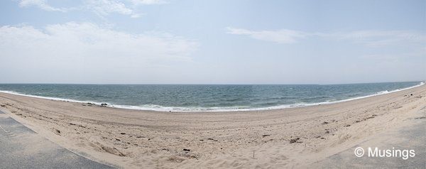
The last composition in this post here was done at a pretty deserted part of Pering Cove Beach. There were lots more activity towards the right end of the beach. That’s not the ocean on the horizon by the way, but Cape Cord Bay.

As before, larger versions of the panoramas are here.
Recent comments