There’s a couple of sites that I rely on a lot whenever I make a trip overseas: one’s Tripadvisor, and the other is Google Maps. The latter is especially handy, since for every journey I have to plan for during a trip, I like to find out first all the transportation options, timings, fares and routes to get from one point to the other.
There’s one problem with Google Maps though: it’s an exclusively online application. You need to be connected online for it to work. And while there’s a lot of handphones these days, including the iPhone, with mobile versions of Google Maps, you don’t want to be paying GPRS-rated prices in a foreign country just to navigate around. It’s bad enough if you’re walking. It’s worse when you’re traveling by vehicle since the distance covered would be far greater.
What I’ve always done so far is to do print screens of the maps, then stitch them up to an over-sized version. That’s never worked very well – since it’s a lot of work to align and stitch the images up (haven’t tried those panoramic stitching programs on maps yet but I think they should work well).
That’s what I had to do regardless for the San Francisco trip in March this year though. My notebook was packed with about 25 maps of varying sizes covering each of the trips we were making and vicinities throughout the 8 days stay.
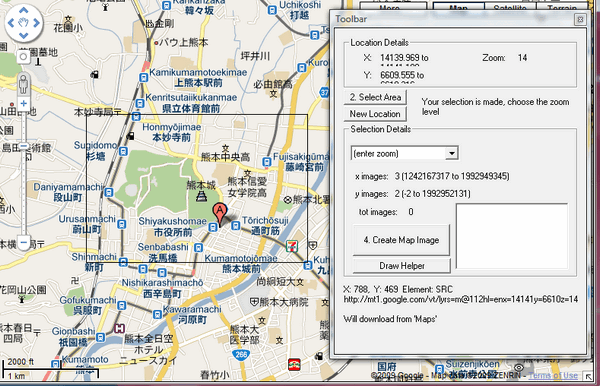
I was dreading map production for the coming trip to Kumamoto in Kyushu as this time it’s all in Japanese LOL. Fortunately, I’ve (finally!) found a program that streamlines all that stitching into a single automated process – and it’s a Windows freeware application called Google Maps Buddy.

This is a tiny application that runs within its browser. It lets you specify which areas you’d like included in your map, and you also indicate the zoom / detail level you want. The nifty little program then automatically downloads all the small tile maps, and stitches them all up seamlessly into a gigantic map for you. I’ve been able to create a city map of Kumamoto, and also a much larger map of a good part of the prefecture – since I’ll likely be commuting daily between the college I’ll be lecturing at, and also the city where my hotel is likely going to be.
The largest map I’ve produced now is 7710×10280 pixels. If I’d manually stitched client images, it would had likely taken me maybe 3-4 hours to get them all done. Using Google Maps Buddy: it took me 10 seconds to specify the map parameters, and the program churned out the image in the background on its own. Just amazing.:)
Cool buddy! :P